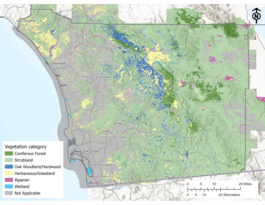
Climate Resilient Connectivity for California’s South Coast Ecoregion
The goal for this project was to create comprehensive species and landscape analyses and mapping through a novel combination of modeling and planning.
The connectivity linkage maps for the south coast ecoregion developed through this project will inform the production of a guide to support practical, proactive management of biodiversity under climate change.

Climate Resilient Connectivity StoryMap
Explore habitat connectivity in California's south coast ecoregion![]()
More Climate Adaptation Science Projects

This project aims to enhance our understanding of the challenges facing Southern California's montane forests due to escalating threats worsened by climate change. Through multi-jurisdictional collaboration, we are identifying strategies to bolster forest resilience.

CNNCTS advances a model of Indigenous-led land stewardship for climate adaptation and resilience. This project includes integrated support of coastal resilience, cultural and prescribed fire, climate-informed restoration, and land rematriation efforts.
In this project, IEMM is focused on understanding how the restoration of natural and working lands can be used effectively to help San Diego County achieve its greenhouse gas reduction goals.

FaCeT is a bi-coastal platform co-created by IEMM that allows users to track fisheries-relevant physical and biological ocean features. This tool is part of an ongoing NASA Biodiversity and Ecological Forecasting project supporting climate-ready and sustainable fisheries practices.
A team of ecologists and climatologists reviewed and reported on the most current, regionally specific climate information. This was paired with current research on species and habitats of the South Coast that are at risk due to climate and other stressors.